
.svg/330px-Flag_of_Tonga_(1862-1866).svg.png)
Tuʻi Tonga Empire
Attested 500 CE – 1815 CE
Empire based in Oceania during around 950s–1865
Wikipedia
The opening of the article, and a way into the rest of it without leaving the site.
Tuʻi Tonga Empire on Wikipedia.
From Wikipedia, available under CC BY-SA 4.0.
How these dates were made
Why this bar's edges are floors, not a founding and a fall.
The atlas draws the world at 18 moments in time, not continuously. This bar runs from the first snapshot in which Tuʻi Tonga Empire appears to the last, so both edges are floors — the earliest and latest years it is attested, not a founding and a dissolution.
Running at the same time
Records whose own span overlaps this one, found by the same test the canvas draws with. The bar under each card is where it sits inside this one.
.jpg/500px-%D0%9C%D0%B0%D1%83%D0%B7%D0%BE%D0%BB%D0%B5%D1%98_%D0%A5%D0%BE%D0%B4%D0%B6%D0%B5_%D0%90%D1%85%D0%BC%D0%B5%D0%B4%D0%B0_%D0%88%D0%B0%D1%81%D0%B0%D0%B2%D0%B8%D1%98%D0%B0_(%D0%B3%D1%80%D0%B0%D0%B4_%D0%A2%D1%83%D1%80%D0%BA%D0%B5%D1%81%D1%82%D0%B0%D0%BD%2C_%D0%9A%D0%B0%D0%B7%D0%B0%D1%85%D1%81%D1%82%D0%B0%D0%BD).jpg)
Landmark
Mausoleum of Khoja Ahmed Yasawi
1389 CE – still standingPolity
central Asian khanates
Attested 1530 CE – 1900 CETrade route
Silk Road Southern Branch
200 BCE – 1450 CE
Figure · Arabian Peninsula
Muhammad
570 CE – 632 CE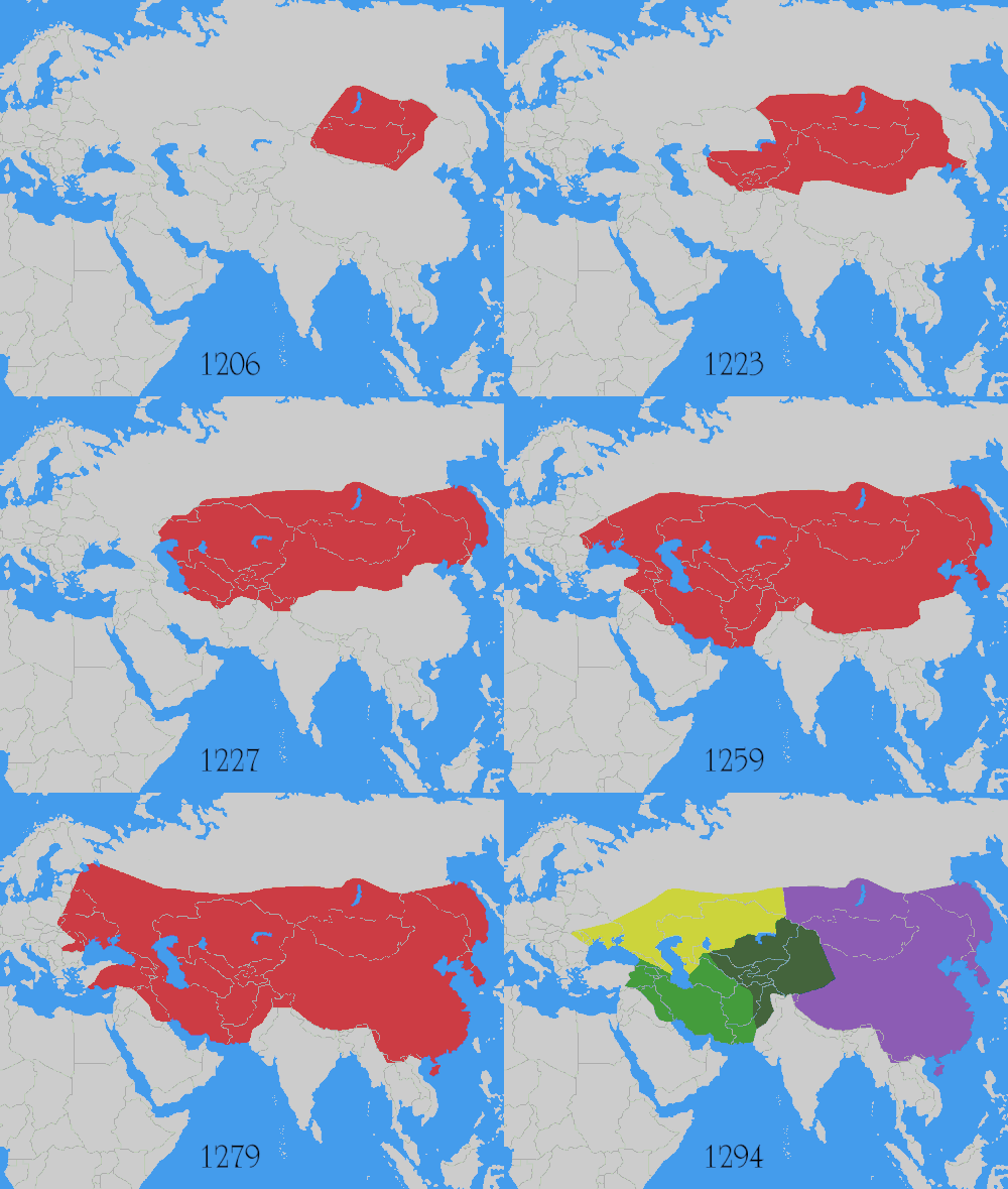
Conflict
Mongol Conquests
1206 CE – 1368 CELandmark
Afrasiab (Ancient Samarkand)
500 BCE – 1220 CE
Polity
Srivijaya Empire
650 CE – 1400 CETrade route
Manila Galleon Return Route
1565 CE – 1815 CEDated moments inside this span
Events the timeline places between 500 CE and 1815 CE.
And in the rest of the world
Records running through the same years, on the other side of the map.
Image credits5 pictures from Wikimedia Commons
- Flag of Tonga (1862-1866)Thommy · Public domain
- Mausoleum of Khoja Ahmed YasawiPetar Milošević · CC BY-SA 3.0
- Muhammadبلال الدويك · CC BY-SA 3.0
- Mongol conquestsUser:Astrokey44 · CC BY-SA 3.0
- Srivijaya EmpireGunawan Kartapranata · CC BY-SA 3.0
.svg)
.jpg)


