

Nobatia
400 CE – 700 CE · 300 years
Medieval kingdom in Lower Nubia
Wikipedia
The opening of the article, and a way into the rest of it without leaving the site.
Nobatia on Wikipedia.
From Wikipedia, available under CC BY-SA 4.0.
How these dates were made
Real dates from Wikidata, checked against the atlas.
These are real dates: Nobatia's founding and dissolution are recorded in Wikidata, and accepted here only because they agree with the centuries the atlas independently drew it in. The atlas itself draws the world at 2 moments in time, not continuously. The strip below covers those snapshots — 600 CE to 700 CE — which sits inside the fuller span above.
Elsewhere in Middle East at the time
Records whose own span overlaps this one, found by the same test the canvas draws with. The bar under each card is where it sits inside this one.

Landmark · Middle East
Yazd Atash Behram
470 CE – still standing.jpg/500px-NubianMeroePyramids30sep2005(2).jpg)
Polity · Middle East
Meroe
Attested 500 BCE – 400 CETrade route · Middle East
Mediterranean Southern Route
331 BCE – 1500 CE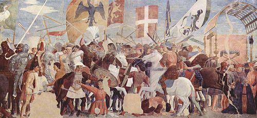
Conflict · Middle East
Byzantine–Sassanid War of 602–628
602 CE – 628 CELandmark · Middle East
St. Catherine's Monastery & Mount Sinai
548 CE – still standing
Polity · Middle East
Himyarite Kingdom
109 BCE – 525 CETrade route · Middle East
Maritime Silk Road – Red Sea Branch
200 BCE – 1500 CE
Conflict · Middle East
Early Muslim Conquests
632 CE – 750 CEDated moments inside this span
Events the timeline places between 400 CE and 700 CE.
And in the rest of the world
Records running through the same years, on the other side of the map.
Image credits6 pictures from Wikimedia Commons
- NobatiaSimonP · CC BY-SA 2.0
- Fire Temple of YazdZenith210 · CC BY-SA 3.0
- MeroëWufei07 · Public domain
- Byzantine–Sasanian War of 602–628Piero della Francesca · Public domain
- HimyarDamiKarv · CC BY-SA 4.0
- Map of expansion of CaliphateDieBuche · Public domain


.jpg)


