

Mauretania
300 BCE – 698 CE · 998 years
Region in the ancient Maghreb
Wikipedia
The opening of the article, and a way into the rest of it without leaving the site.
Mauretania on Wikipedia.
From Wikipedia, available under CC BY-SA 4.0.
How these dates were made
Real dates from Wikidata, checked against the atlas.
These are real dates: Mauretania's founding and dissolution are recorded in Wikidata, and accepted here only because they agree with the centuries the atlas independently drew it in. The atlas itself draws the world at 2 moments in time, not continuously. The strip below covers those snapshots — 200 BCE to 100 BCE — which sits inside the fuller span above.
Elsewhere in Africa at the time
Records whose own span overlaps this one, found by the same test the canvas draws with. The bar under each card is where it sits inside this one.

Landmark · Africa
Osun-Osogbo Sacred Grove
200 BCE – still standing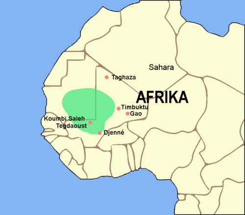
Polity · Africa
Empire of Ghana
100 CE – 1200 CETrade route · Africa
Trans-Saharan Western Route
400 CELandmark · Africa
Djenné-Djenno
250 BCE – 1400 CE.svg/500px-Umayyad_Caliphate_720_AD_(orthographic_projection).svg.png)
Polity · Africa
Umayyad Caliphate
661 CE – 750 CETrade route · Africa
Trans-Saharan Eastern Route
400 CE
Landmark · Africa
Ile-Ife
500 CE – still standingPolity · Africa
Saharan Pastoral Nomads
Attested 2000 BCE – 200 BCEDated moments inside this span
Events the timeline places between 300 BCE and 698 CE.
And in the rest of the world
Records running through the same years, on the other side of the map.
Image credits5 pictures from Wikimedia Commons
- MauretaniaPublic domain
- Osun-OsogboABORISADEADETONA · CC BY-SA 4.0
- Ghana EmpireLuxo · CC BY-SA 3.0
- Umayyad Caliphate 720 AD (orthographic projection)Ergovius · CC BY-SA 4.0
- IfẹOramfe · CC BY 4.0


.svg)
