
How these dates were made
Why this bar's edges are floors, not a founding and a fall.
The atlas draws the world at 27 moments in time, not continuously. This bar runs from the first snapshot in which Khoiasan appears to the last, so both edges are floors — the earliest and latest years it is attested, not a founding and a dissolution.
Elsewhere in Africa at the time
Records whose own span overlaps this one, found by the same test the canvas draws with. The bar under each card is where it sits inside this one.
_(8288918733).jpg/500px-Leptis_Magna_(29)_(8288918733).jpg)
Landmark · Africa
Leptis Magna
1000 BCE – still standing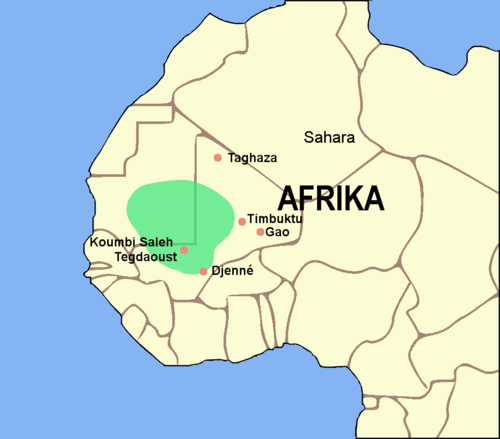
Polity · Africa
Empire of Ghana
100 CE – 1200 CETrade route · Africa
Trans-Saharan Western Route
400 CEConflict · Africa
Kanem–Bornu Wars
700 CE – 1846 CE
Landmark · Africa
Volubilis
300 BCE – 1200 CE
Polity · Africa
Morocco
Founded 789 CE · attested to 2026 CETrade route · Africa
Trans-Saharan Eastern Route
400 CEConflict · Africa
Ghana–Almoravid Conflict
1054 CE – 1083 CEDated moments inside this span
Events the timeline places between 1500 BCE and 1500 CE.
And in the rest of the world
Records running through the same years, on the other side of the map.
Image credits4 pictures from Wikimedia Commons
- Leptis Magnajoepyrek from Richmond, Va, USA · CC BY-SA 2.0
- Ghana EmpireLuxo · CC BY-SA 3.0
- VolubilisSubhros · CC BY-SA 3.0
- Flag of MoroccoDenelson83, Zscout370 · Public domain
_(8288918733).jpg)


