
How these dates were made
Why this bar's edges are floors, not a founding and a fall.
The atlas draws the world at one moment in time, not continuously. This bar runs from the first snapshot in which Florida (Spain) appears to the last, so both edges are floors — the earliest and latest years it is attested, not a founding and a dissolution.
Elsewhere in Americas at the time
Records whose own span overlaps this one, found by the same test the canvas draws with. The bar under each card is where it sits inside this one.
.jpeg/500px-Canyon_River_Tree_(165872763).jpeg)
Landmark · Americas
Grand Canyon
3000 BCE – still standing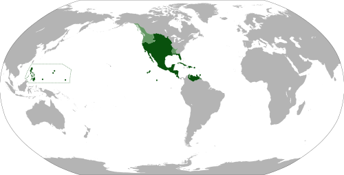
Polity · Americas
Vice-Royalty of New Spain
Attested 1530 CE – 1815 CETrade route · Americas
Spanish Treasure Fleet Return
1566 CE – 1790 CE
Conflict · Americas
Comanche Wars
1706 CE – 1875 CE.jpg/500px-Mammoth_Cave_Rotunda_(USGS_Lwt02830).jpg)
Landmark · Americas
Mammoth Cave
3000 BCE – still standing_(cropped).svg/500px-Map_of_the_Viceroyalty_of_Peru_(%2Bclaimed_Patagonian_and_Amazonic_territories)_(cropped).svg.png)
Polity · Americas
Vice-Royalty of Peru
Attested 1650 CE – 1815 CETrade route · Americas
Atlantic Return (Sugar & Tobacco)
1600 CE – 1850 CE
Landmark · Americas
Hawaii Volcanoes
3000 BCE – still standingAnd in the rest of the world
Records running through the same years, on the other side of the map.
Image credits6 pictures from Wikimedia Commons
- Grand CanyonLennart Sikkema · CC BY 3.0
- Map of the Viceroyalty of New SpainEddo · CC BY-SA 3.0
- Comanche WarsPublic domain
- Mammoth Cave National ParkWillis Thomas Lee · Public domain
- Map of the Viceroyalty of Peru (+claimed Patagonian and Amazonic territories) (cropped)Milenioscuro Derivative work: Janitoalevic · CC BY-SA 3.0
- Hawaiʻi Volcanoes National ParkBrocken Inaglory · CC BY-SA 3.0
.jpeg)


.jpg)
_(cropped).svg)
