

Hampi
1336 CE – 1565 CE · 229 years
Ruins of the Vijayanagara Empire capital, with over 1,600 monuments spread across a boulder-strewn landscape in India
Wikipedia
The opening of the article, and a way into the rest of it without leaving the site.
Hampi on Wikipedia.
From Wikipedia, available under CC BY-SA 4.0.
Who held this ground
Borders from dated snapshots, up to a century apart; precision varies.
Reconstruction
- Before it was built (3000 BCE–1300 CE)
- Sultanate of Delhi (1400 CE) Border precision: Approximate
- Vijayanagara (1492 CE–1650 CE) Border precision: Approximate
- Mughal Empire (1700 CE–1715 CE) Border precision: Defined
- Nizam's Dominions (1783 CE–1800 CE) Border precision: Defined
- Maratha Confederacy (1815 CE) Border precision: Defined
- British Raj (1880 CE–1938 CE) Border precision: Defined
- India (1945 CE–2026 CE) Border precision: Defined
- Defined
- Approximate
Elsewhere in South Asia at the time
Records whose own span overlaps this one, found by the same test the canvas draws with. The bar under each card is where it sits inside this one.

Landmark · South Asia
Sixty Dome Mosque
1459 CE – still standing
Polity · South Asia
Mughal Empire
1526 CE – 1857 CEConflict · South Asia
Mughal Conquests of India
1526 CE – 1707 CE
Landmark · South Asia
Blue Mosque of Mazar-i-Sharif
1481 CE – still standing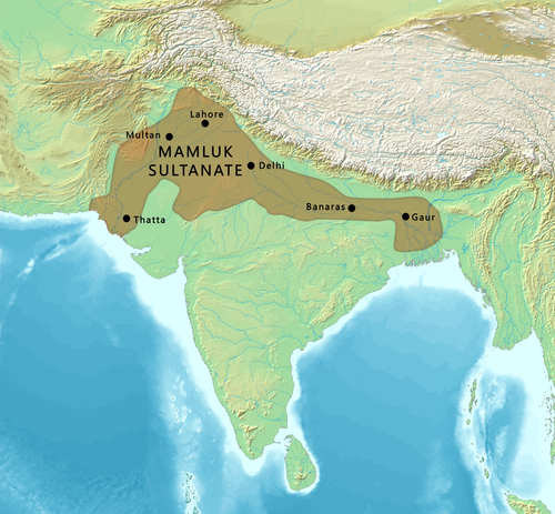
Polity · South Asia
Sultanate of Delhi
1200 CE – 1526 CEConflict · South Asia
Delhi Sultanate Wars
1206 CE – 1398 CE
Landmark · South Asia
Goa
1510 CE – still standingPolity · South Asia
Islamic and Hindu states
Attested 1530 CE – 1650 CEDated moments inside this span
Events the timeline places between 1336 CE and 1565 CE.
And in the rest of the world
Records running through the same years, on the other side of the map.
Image credits 6 pictures from Wikimedia Commons
- Hampi iMahesh · CC BY-SA 4.0
- Sixty Dome Mosque মোয়ায মাহমুদ · CC BY-SA 4.0
- Mughal Empire Justus Perthes, Gotha./Charles Joppen · GFDL
- Mausoleum of Imam Ali Sgt. Kimberly Lamb (U.S. Armed Forces) · Public domain
- Delhi Sultanate Maps created from DEMIS Mapserver, which are public domain. Koba-chan Territorial area: प… · CC BY-SA 3.0
- Goa Sam 8393 · CC BY-SA 4.0


