

El Tajín
600 BCE – 1230 CE · 1,830 years
Mesoamerican city in Veracruz famous for the Pyramid of the Niches with 365 window-like recesses, capital of the Classic Veracruz culture
Wikipedia
The opening of the article, and a way into the rest of it without leaving the site.
El Tajín on Wikipedia.
From Wikipedia, available under CC BY-SA 4.0.
Who held this ground
Borders from dated snapshots, up to a century apart; precision varies.
Reconstruction
- Before it was built (3000 BCE–700 BCE)
- Maize farmers (500 BCE–400 BCE) Border precision: Approximate
- No border recorded here in this snapshot (323 BCE–300 BCE)
- Maize farmers (200 BCE) Border precision: Approximate
- No border recorded here in this snapshot (100 BCE–400 CE)
- Veracruz civilization (500 CE–700 CE) Border precision: Approximate
- Mesoamerican city-states and chiefdoms (800 CE–1200 CE) Border precision: Approximate
- No border recorded here in this snapshot (1279 CE–1400 CE)
- Totonaco (1492 CE) Border precision: Approximate
- Aztec Empire (1500 CE) Border precision: Approximate
- New Spain (1530 CE) Border precision: Approximate
- Vice-Royalty of New Spain (1600 CE–1815 CE) Border precision: Approximate
- Mexico (1880 CE–2026 CE) Border precision: Defined
- Defined
- Approximate
Elsewhere in Americas at the time
Records whose own span overlaps this one, found by the same test the canvas draws with. The bar under each card is where it sits inside this one.
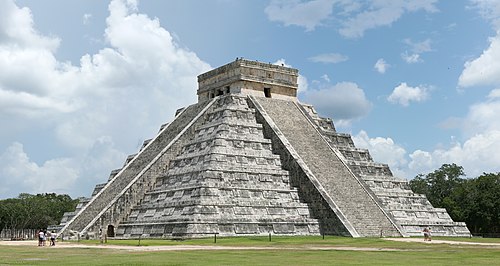
Landmark · Americas
Chichen Itza
600 CE – still standing
Polity · Americas
Chorrera
Attested 1500 BCE – 100 BCETrade route · Americas
Polynesian Eastward Voyaging
700 CE – 1300 CEConflict · Americas
Tongan Maritime Power and Rivalries
1200 CE – 1600 CE
Landmark · Americas
Teotihuacan
200 BCE – still standing
Polity · Americas
Monte Albán
Attested 323 BCE – 700 CETrade route · Americas
Voyage to Hawai'i
700 CE – 1300 CEConflict · Americas
Maya City-State Wars
400 BCE – 900 CEDated moments inside this span
Events the timeline places between 600 BCE and 1230 CE.
And in the rest of the world
Records running through the same years, on the other side of the map.
Image credits 5 pictures from Wikimedia Commons
- El Tajín CC BY-SA 2.0
- Chichen Itza Daniel Schwen · CC BY-SA 4.0
- Chorrera culture NASA · Public domain
- Teotihuacan Hdlrosa · CC BY-SA 4.0
- Monte Albán nsaum75 !Dígame¡ · CC BY-SA 3.0


