
Landmark Americas wonder
To Sua Ocean Trench
3000 BCE – still standing
Giant lava-formed swimming hole connected to the ocean by underground channels on Samoa's Upolu island
Who held this ground
Borders from dated snapshots, up to a century apart; precision varies.
Reconstruction
- No border recorded here in this snapshot (3000 BCE–400 CE)
- Tuʻi Tonga Empire (500 CE–600 CE) Border precision: Approximate
- No border recorded here in this snapshot (700 CE–900 CE)
- Tuʻi Tonga Empire (1000 CE–1815 CE) Border precision: Approximate
- Samoa (1880 CE) Border precision: Defined
- German Samoa (1900 CE–1914 CE) Border precision: Defined
- Western Samoa (1920 CE–1960 CE) Border precision: Defined
- Samoa (1994 CE–2026 CE) Border precision: Defined
Border precision
- Defined
- Approximate
Elsewhere in Americas at the time
Records whose own span overlaps this one, found by the same test the canvas draws with. The bar under each card is where it sits inside this one.
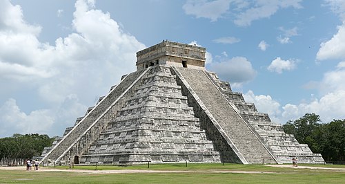
Landmark · Americas
Chichen Itza
600 CE – still standing
Polity · Americas
Canada
Founded 1815 CE · attested to 2026 CETrade route · Americas
Mesoamerican Trade Network
1200 BCE – 1521 CEConflict · Americas
Hawaiian Unification Wars
1782 CE – 1810 CE
Landmark · Americas
Machu Picchu
1450 CE – still standing
Polity · Americas
Mexico
Founded 1810 CE · attested to 2026 CETrade route · Americas
Polynesian Eastward Voyaging
700 CE – 1300 CEConflict · Americas
Argentine War of Independence
1810 CE – 1818 CEDated moments inside this span
Events the timeline places between 3000 BCE and 2026 CE.
And in the rest of the world
Records running through the same years, on the other side of the map.
Image credits 4 pictures from Wikimedia Commons
- Chichen Itza Daniel Schwen · CC BY-SA 4.0
- Flag of Canada (Pantone) Original: George F. G. Stanley Modified by: The original uploader was Illegitimate Barris… · Public domain
- Machu Picchu Draceane · CC BY-SA 4.0
- Flag of Mexico Omar Alejandro Covarrubias Neri, 9 April 2006. Based on the 1968 arms by Francisco Eppens… · Public domain


