

Landmark archaeological
Jiaohe Ruins
200 BCE – 1400 CE · 1,600 years
Ancient Silk Road garrison city carved into a leaf-shaped plateau between two rivers in Xinjiang, China
Wikipedia
The opening of the article, and a way into the rest of it without leaving the site.
Jiaohe ruins on Wikipedia.
From Wikipedia, available under CC BY-SA 4.0.
Who held this ground
Borders from dated snapshots, up to a century apart; precision varies.
Reconstruction
- Before it was built (3000 BCE–300 BCE)
- Yuezhi (200 BCE) Border precision: Approximate
- No border recorded here in this snapshot (100 BCE–300 CE)
- Ruanruan (400 CE–500 CE) Border precision: Approximate
- No border recorded here in this snapshot (600 CE)
- Karluks (700 CE) Border precision: Approximate
- Tibetan Empire (800 CE) Border precision: Approximate
- Tibet (900 CE) Border precision: Approximate
- No border recorded here in this snapshot (1000 CE)
- Cuman-Kipchak confederation (1100 CE) Border precision: Approximate
- Mongols (1200 CE) Border precision: Approximate
- Chagatai Khanate (1279 CE–1500 CE) Border precision: Approximate
- No border recorded here in this snapshot (1530 CE)
- central Asian khanates (1600 CE–1715 CE) Border precision: Approximate
- Qing Empire (1783 CE–1800 CE) Border precision: Not stated
- Manchu Empire (1815 CE–1900 CE) Border precision: Defined
- Xinjiang (1914 CE–1945 CE) Border precision: Defined
- China (1960 CE–2026 CE) Border precision: Defined
Border precision
- Defined
- Approximate
- Not stated
Running at the same time
Records whose own span overlaps this one, found by the same test the canvas draws with. The bar under each card is where it sits inside this one.

Landmark
Mogao Caves
366 CE – still standing
Polity
Srivijaya Empire
650 CE – 1400 CEFigure · Judea
Yose ben Yoezer
200 BCE – 161 BCETrade route
Silk Road Southern Branch
200 BCE – 1450 CE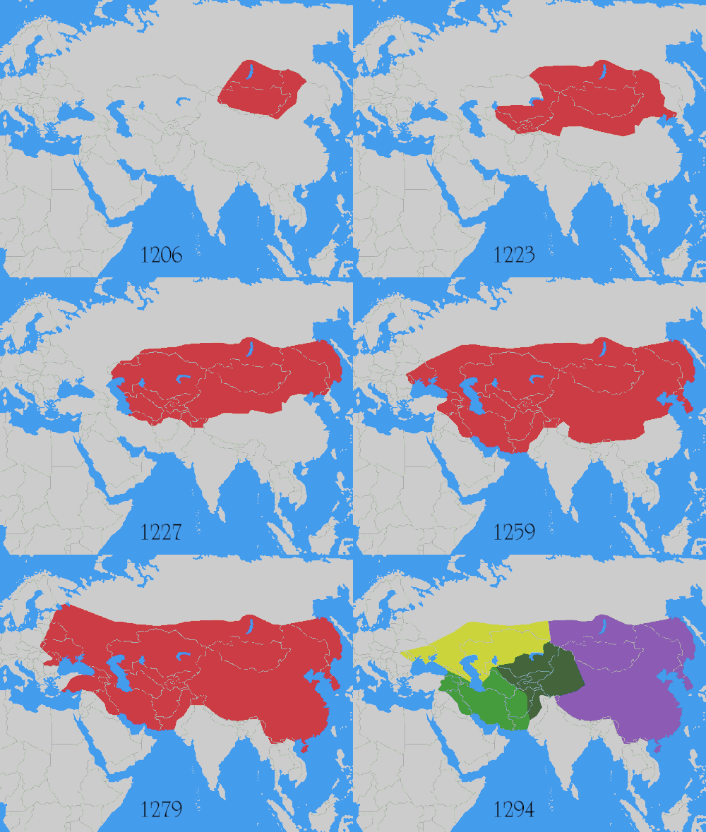
Conflict
Mongol Conquests
1206 CE – 1368 CE
Landmark
Mausoleum of Khoja Ahmed Yasawi
1389 CE – still standing
Polity
Chagatai Khanate
1225 CE – 1687 CEFigure · Jerusalem / Alexandria
Joshua ben Perachiah
140 BCE – 76 BCEDated moments inside this span
Events the timeline places between 200 BCE and 1400 CE.
And in the rest of the world
Records running through the same years, on the other side of the map.
Image credits 6 pictures from Wikimedia Commons
- Jiaohe ruins Colegota · CC BY-SA 2.5 es
- Mogao Caves xiquinhosilva · CC BY 2.0
- Srivijaya Empire Gunawan Kartapranata · CC BY-SA 3.0
- Mongol conquests User:Astrokey44 · CC BY-SA 3.0
- Mausoleum of Khoja Ahmed Yasawi Petar Milošević · CC BY-SA 3.0
- Chagatai Khanate map en MapMaster · CC BY 3.0


