

Wikipedia
The opening of the article, and a way into the rest of it without leaving the site.
Sabines on Wikipedia.
From Wikipedia, available under CC BY-SA 4.0.
How these dates were made
Why this bar's edges are floors, not a founding and a fall.
The atlas draws the world at one moment in time, not continuously. This bar runs from the first snapshot in which Sabines appears to the last, so both edges are floors — the earliest and latest years it is attested, not a founding and a dissolution.
Elsewhere in Europe at the time
Records whose own span overlaps this one, found by the same test the canvas draws with. The bar under each card is where it sits inside this one.

Landmark · Europe
Plitvice Lakes
3000 BCE – still standing
Polity · Europe
Greek city-states
Attested 1500 BCE – 300 BCE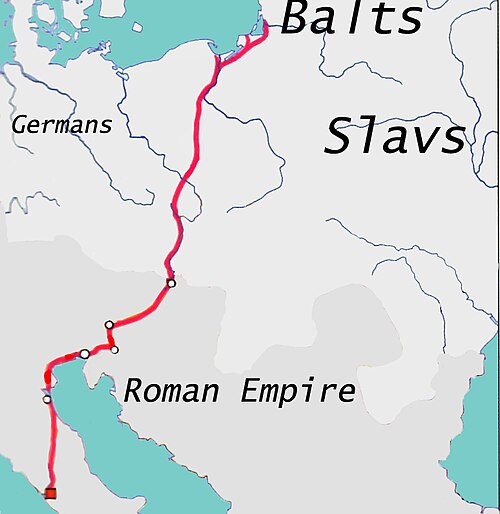
Trade route · Europe
Amber Road
1000 BCE – 400 CE
Conflict · Europe
Conquests of Alexander the Great
334 BCE – 323 BCE
Landmark · Europe
Giant's Causeway
3000 BCE – still standing
Polity · Europe
Celts
Founded 1200 BCE · attested to 100 BCEConflict · Europe
Roman–Etruscan Wars
509 BCE – 264 BCE
Landmark · Europe
Danube Delta
3000 BCE – still standingDated moments inside this span
Events the timeline places between 323 BCE and 323 BCE.
And in the rest of the world
Records running through the same years, on the other side of the map.
Image credits8 pictures from Wikimedia Commons
- Latium -5th Century map-enSémhur ( talk ) · CC BY-SA 4.0
- Plitvice Lakes National ParkZysko serhii · CC BY-SA 4.0
- PolisA.Savin · CC BY-SA 3.0
- Amber RoadBearas · CC BY-SA 3.0
- Wars of Alexander the GreatThe Guardian (DEA/G Nimatallah/De Agostini/Getty Images) · Public domain
- Giant's Causewaycode poet on flickr. · CC BY-SA 2.0
- CeltsQuartierLatin1968,The Ogre,Dbachmann · CC BY-SA 3.0
- Danube DeltaEuropean Space Agency · Attribution


